
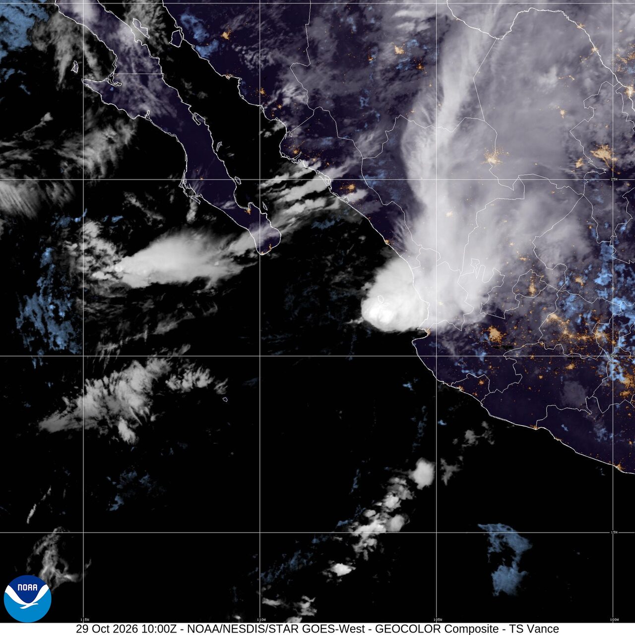
Tropical Storm Vance off Mexico; flood threat in the Southwest: Weather briefing for October 29, 2026
Tropical Storm Vance was still off Mexico early Thursday, but the National Hurricane Center said its rain threat to parts of western Mexico continued even with no coastal watches or warnings in effect. In the United States, the weather story shifted away from severe thunderstorms and toward heavy rain, with the National Weather Service highlighting a multi-day flash flood threat across parts of the southern High Plains and Southwest through tonight. Wildfire activity remained active nationally, and AirNow said wildfire smoke was affecting air quality in multiple states.
Past 24 Hours
In the United States, Wednesday's severe weather threat produced tornado watches and mesoscale discussions from parts of Iowa and Minnesota into western Wisconsin, but by early Thursday the Storm Prediction Center said severe thunderstorms were no longer forecast anywhere in the country today or tonight.
That shift leaves flooding, not organized severe storms, as the main U.S. weather concern into the end of the day.
Wildland fire activity also continued in the United States. The National Interagency Fire Center reported 10 large fires being suppressed nationwide, with 366,942 acres burning in large fires as of Wednesday night.
What's Happening Now
Tropical Storm Vance was centered near 21.0 north, 108.4 west at 2:00 a.m. MST, about 180 miles west-northwest of Cabo Corrientes, Mexico. The National Hurricane Center said Vance had top winds of 40 mph and was moving north-northeast at 7 mph. The center's headline said the flood and mudslide threat continued for Mexico. No watches or warnings were in effect with the latest advisory.
Across the United States, the National Weather Service said a multi-day heavy rain event was under way in the southern Plains and Southwest, while Bering Sea storms in Alaska were bringing elevated water levels, isolated coastal flooding, high surf, erosion and strong winds to western Alaska. The Weather Prediction Center said there was a slight risk of excessive rainfall over parts of the southern High Plains on Thursday, with another slight risk over parts of the Southwest on Friday and Saturday.
Smoke was another active hazard. AirNow posted a national alert for wildfire smoke in multiple states and advised people to use the Fire and Smoke Map to check local conditions. NIFC's latest national statistics showed three new large fires and 10 large fires being suppressed.
Outlook Through Tonight
The National Weather Service said showers and thunderstorms would keep a flash flood threat in parts of the southern High Plains and Southwest through tonight. That includes areas where repeated rounds of rain could overwhelm dry washes, burn scars and urban drainage.
For the severe weather side of the forecast, the Storm Prediction Center said no severe thunderstorms were forecast across the United States today or tonight. That does not rule out ordinary thunderstorms, but it does mean the organized tornado, wind and hail threat is expected to stay low through tonight.
Vance is forecast to remain the main named tropical system affecting North America through tonight. Even offshore, its moisture will keep the risk of heavy rain over parts of western Mexico, where flooding and mudslides can continue after the strongest winds ease.

