
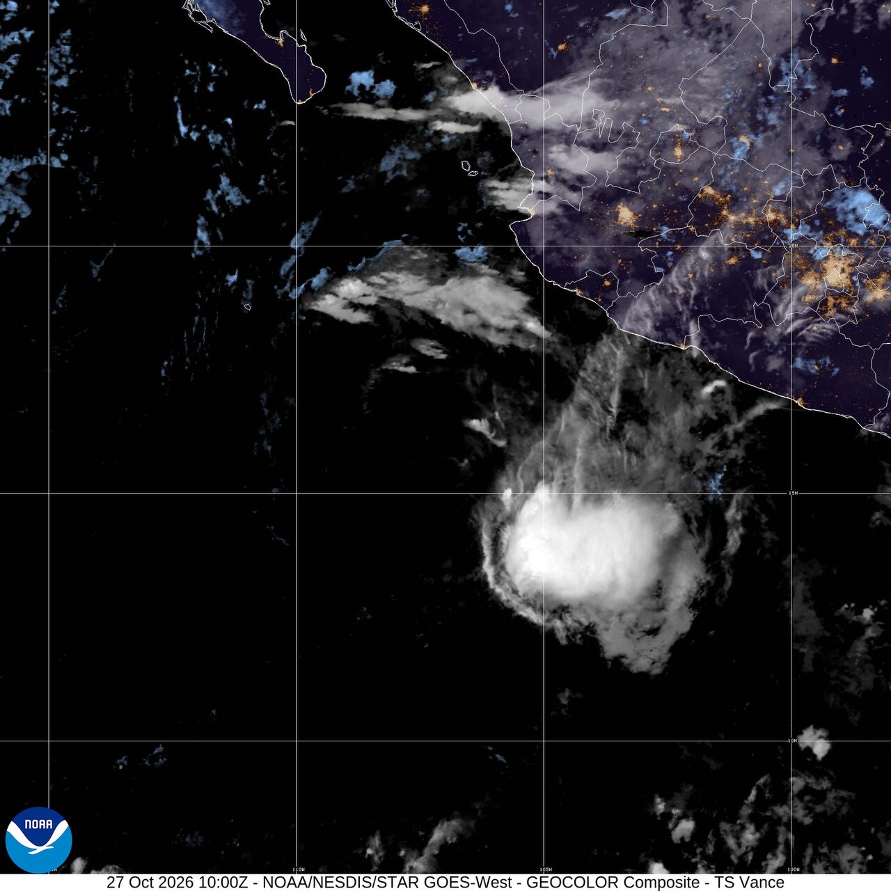
Pacific storm hits Northwest; Vance weakens offshore: Weather briefing for October 27, 2026
Tropical Storm Vance weakened offshore of southwestern Mexico Tuesday, but the broader U.S. weather picture was led by a Pacific storm bringing rain and high-elevation snow into the Pacific Northwest and northern Rockies, with a Bering Sea storm driving strong winds, heavy precipitation and elevated water levels in Alaska. In the United States, the most focused near-term threat was in South Florida, where the Weather Prediction Center posted a marginal flash flood risk through early Wednesday along parts of the peninsula's east coast. Elsewhere, a Pacific storm was spreading rain and high-elevation snow into the Northwest and northern Rockies, while wildfire smoke continued to affect air quality in parts of the United States.
Past 24 Hours
Tropical Storm Vance weakened steadily through the past day as it drifted and then turned northwest over open water off Mexico's Pacific coast. The National Hurricane Center's 2 a.m. MST advisory placed the center near 15.9 north and 106.9 west, with maximum sustained winds of 45 mph and a minimum central pressure of 1002 mb. Vance was moving northwest at 8 mph. No coastal watches or warnings were in effect.
That matters because even a weakening tropical storm can keep rough surf, bands of rain and hazardous marine conditions going near the Mexican coast while remaining just offshore. The latest NHC advisory still kept the center a few hundred miles from land, with the nearest reference points 275 miles southwest of Manzanillo and 320 miles south-southwest of Cabo Corrientes.
What's Happening Now
In South Florida, the Weather Prediction Center's Day 1 excessive rainfall outlook showed a marginal flash flood risk through 8 a.m. EDT Wednesday. Showers and thunderstorms were expected along the eastern side of the peninsula, with isolated instances where rain could exceed local flash flood guidance, especially in urban and low-lying areas.

Across the Northwest, the National Weather Service said a Pacific storm was bringing rain and high-elevation snow into the Pacific Northwest and northern Rockies. The broad setup favors wet travel and rising mountain snow totals rather than a concentrated severe-weather outbreak. The Storm Prediction Center said severe thunderstorms were not expected anywhere in the continental United States on Tuesday, although a few non-severe storms could form in southeast New Mexico and far West Texas.
Wildfire smoke also remained a national air-quality concern. AirNow posted a system alert for wildfire smoke in multiple states and directed users to its fire and smoke map for local impacts.
Outlook Through Tonight
Vance is expected to keep weakening tonight while staying offshore of southwestern Mexico. The National Hurricane Center said the storm had no watches or warnings in effect with its latest advisory, a sign that the main hazards should stay over open water even as rain and marine impacts linger near the coast.
In the United States, the most organized overnight hazard is the Pacific storm bringing rain to the Pacific Northwest and high-elevation snow into the northern Rockies, while repeated downpours in South Florida could still lead to brief street flooding before daybreak Wednesday. In Alaska, the National Weather Service highlighted a series of Bering Sea storms expected to bring strong winds, heavy precipitation and elevated water levels from the west coast to northern Alaska.

