
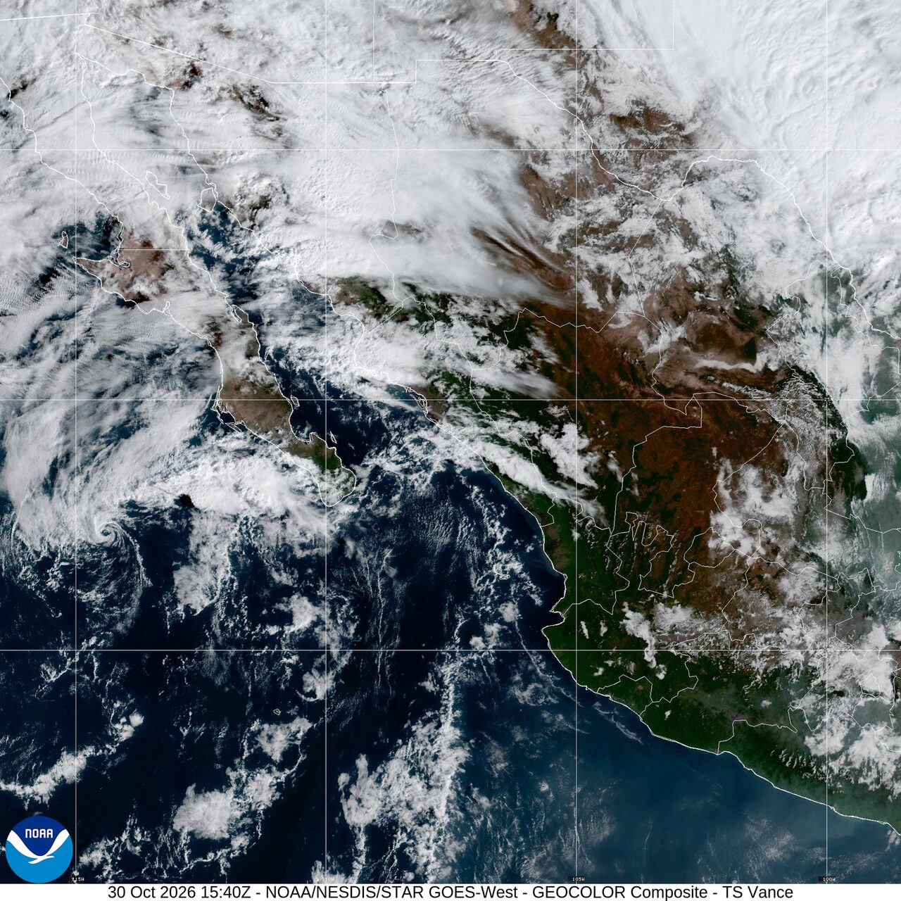
Kansas flooding closes roads as Vance moisture raises flood threat
Flooding closed roads in Marysville, Kansas, after 4 to 6 inches of rain, while moisture from the remnants of Vance spread a flash flood threat from the Southwest into the Southern Plains.
Past 24 Hours
In Marysville, Kansas, at least one road closed before dawn Friday after 4 to 6 inches of rain fell in west central Marshall County, the National Weather Service in Topeka said. Emergency managers said the city park and several roadways were flooded. A river warning remained in effect for the Big Blue River near Blue Rapids, where the river was forecast to crest at 29.7 feet Friday afternoon.
Severe storms in Texas produced five preliminary tornado reports Thursday, including one north of Van Horn and others in Uvalde and Kinney counties, according to the Storm Prediction Center.
What's Happening Now
A coastal flood warning remains in effect for the Florida Keys through 11 p.m. EDT Friday, where the National Weather Service warned of major saltwater flooding, road closures and inundation of low lying homes, businesses and some critical infrastructure.
A separate coastal flood warning remains in effect through 5 a.m. EDT Saturday for coastal Duval County and the St. Johns River basin near Jacksonville. Forecasters said numerous roads could close and low lying property could flood.
Off western Mexico, the National Hurricane Center said Thursday night that Vance no longer had a well defined center. Its moisture was expected to enhance rainfall over the Southwestern United States and Southern Plains during the next few days. The remnants were also expected to bring 1 to 2 inches of rain, with isolated totals above 4 inches, across central and southern Sinaloa, far southwestern Durango and far northwestern Nayarit into early Friday morning.
Outlook Through Tonight
In Arizona, the Storm Prediction Center said isolated severe wind gusts and hail were possible Friday as scattered thunderstorms develop. Parts of the state were under a marginal risk, the lowest of the center's five severe weather categories.
Flood watches remained in effect Friday across parts of Arizona, New Mexico and Texas as moisture from Vance pushed inland. In West Texas, flash flood warnings were posted late Friday morning for parts of Dawson, Gaines, Howard, Mitchell and Scurry counties. Radar and rain gauges showed 1 to 2 inches of rain there, and flooding was already underway, according to the National Weather Service in Midland Odessa.
In Alaska, high wind warnings remained in effect Friday for parts of the Anchorage area and Cordova, while winter storm and winter weather alerts continued in parts of the state. Storm warnings were also posted for some Gulf waters.
Firefighters were working on nine large fires nationwide, with 329,647 acres burning and 581 personnel assigned, according to the National Interagency Fire Center.