
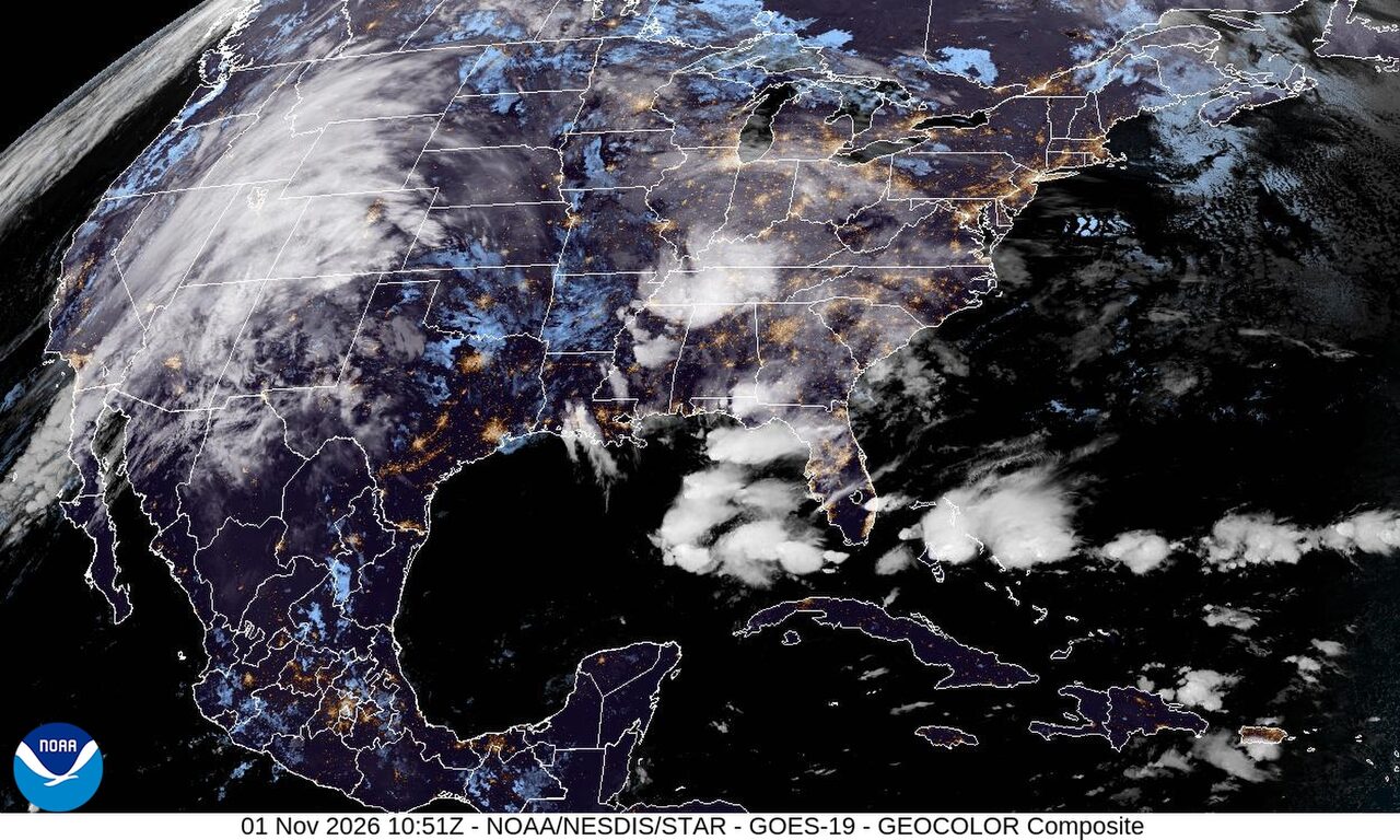
Flooding swamps parts of Louisiana and Mississippi as storms eye southern High Plains
Flooding around Bogalusa and across western Pearl River County was still causing problems at daybreak Sunday after as much as 18 inches of rain fell in parts of southeastern Louisiana and southern Mississippi. More heavy rain was expected in Arizona and South Florida through tonight, while severe thunderstorms could develop this evening in eastern New Mexico and the southern High Plains.
Past 24 Hours
Heavy rain left flood warnings in place early Sunday for Bogalusa in Washington Parish, Louisiana, and for western Pearl River County in Mississippi. The National Weather Service said up to 18 inches of rain had fallen there, with flooding still affecting low spots, creeks and rural roads. A separate flash flood warning in Evangeline Parish said 6 to 15 inches of rain had fallen near Bayou Chicot, Chicot State Park and nearby roads before dawn.
Saturday's preliminary storm reports included a snapped power pole near Shea Boulevard and 64th Street in Paradise Valley, Arizona, and ping pong ball size hail near Sahara Avenue and Maryland Parkway in Las Vegas.
The National Interagency Fire Center said firefighters were working on nine large fires nationwide in Friday's report, with 21,530 acres burning across all active fires. The largest was the Austin Fire about 25 miles southeast of Estacada, Oregon, at 12,888 acres. The Sisi Fire northwest of Stehekin, Washington, had burned 4,774 acres.
What's Happening Now
Flood watches cover much of metro Phoenix, the lower deserts and parts of southern Gila County through late tonight. The National Weather Service said an atmospheric river could bring another 2 to 4 inches of rain in heavier pockets, enough to flood washes and low water crossings. A separate flood watch for metro Phoenix and nearby deserts runs until 5 a.m. MST Monday.
South Florida is also under a flood watch from Miami-Dade through Palm Beach County. The National Weather Service said bands of heavy rain could bring street flooding and road closures from Miami to Fort Lauderdale and West Palm Beach from 10 a.m. Sunday into Monday afternoon.
On Guam, a high surf advisory and rip current statement remain in effect through Monday afternoon ChST. The National Weather Service in Tiyan said north and west facing reefs could see dangerous surf and rip currents. The Guam forecast office said there were no active tropical cyclones in the western North Pacific Sunday.
Outlook Through Tonight
The Storm Prediction Center put parts of eastern New Mexico and the southern High Plains under a slight risk of severe thunderstorms for this evening and tonight, with damaging wind gusts and a tornado threat. A more isolated severe threat could also develop this afternoon in parts of the Desert Southwest.
In the mountains of southwest Colorado, a winter storm warning starts at 5 p.m. MST for the eastern San Juan Mountains above 10,000 feet. The National Weather Service said 8 to 14 inches of snow and gusts up to 50 mph could make travel difficult Sunday night and Monday morning.
Forecasters also warned of a multi-day heavy rain event in the Four Corners and a soggy Sunday in Florida, where the flood threat remained in place across Arizona and the peninsula.