Michigan Weather Radar
As of 12:24 AMLive radar
Open full mapRadar stations in Michigan (MI)
5 stationsOpen a single MI Doppler radar station for a closer look than the national mosaic — the sharpest detail is near each station.
Right now across Michigan
40° to 46°-
Lansing Capital
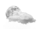 41°
Partly cloudy · feels 37°
41°
Partly cloudy · feels 37°
-
Detroit
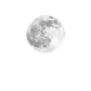 46°
Mostly clear · feels 37°
46°
Mostly clear · feels 37°
-
Grand Rapids
40°
Mostly clear · feels 36°
-
Warren
46°
Mostly clear · feels 38°
-
Sterling Heights
 45°
Mostly cloudy · feels 38°
45°
Mostly cloudy · feels 38°
-
Ann Arbor
45°
Partly cloudy · feels 43°
-
Clinton Township
45°
Partly cloudy · feels 37°
-
Flint
42°
Partly cloudy · feels 34°
-
Dearborn
 46°
Cloudy · feels 42°
46°
Cloudy · feels 42°
-
Livonia
46°
Cloudy · feels 42°
-
Canton
44°
Partly cloudy · feels 38°
-
Troy
46°
Mostly cloudy · feels 42°
Michigan city radar
Michigan climate
Michigan's climate is heavily shaped by the Great Lakes, which surround the state on three sides and create pronounced lake-effect weather patterns. The Lower Peninsula has a humid continental climate, while the Upper Peninsula experiences subarctic conditions during winter. The moderating influence of the lakes delays seasonal transitions, keeping springs cooler and autumns warmer near the shorelines.
Lake-effect snow is Michigan's signature weather phenomenon, occurring when cold Arctic air passes over the relatively warm Great Lakes and picks up moisture. Areas downwind of the lakes, such as the western shore of the Lower Peninsula and much of the Upper Peninsula, can receive extraordinary snowfall totals. The Keweenaw Peninsula averages over 200 inches of snow per season, among the highest in the eastern United States.
Severe thunderstorms and tornadoes affect Michigan primarily from May through August, with the Lower Peninsula being more vulnerable. The Great Lakes can also generate powerful storms with high waves and dangerous currents along the beaches. Summers are pleasant with temperatures in the 70s and 80s, and the state's many lakes and forests provide natural cooling that draws residents and tourists alike to the outdoors.
Nearby states
Weather briefing
All posts


Explore the live map
Open mapPopular cities


