
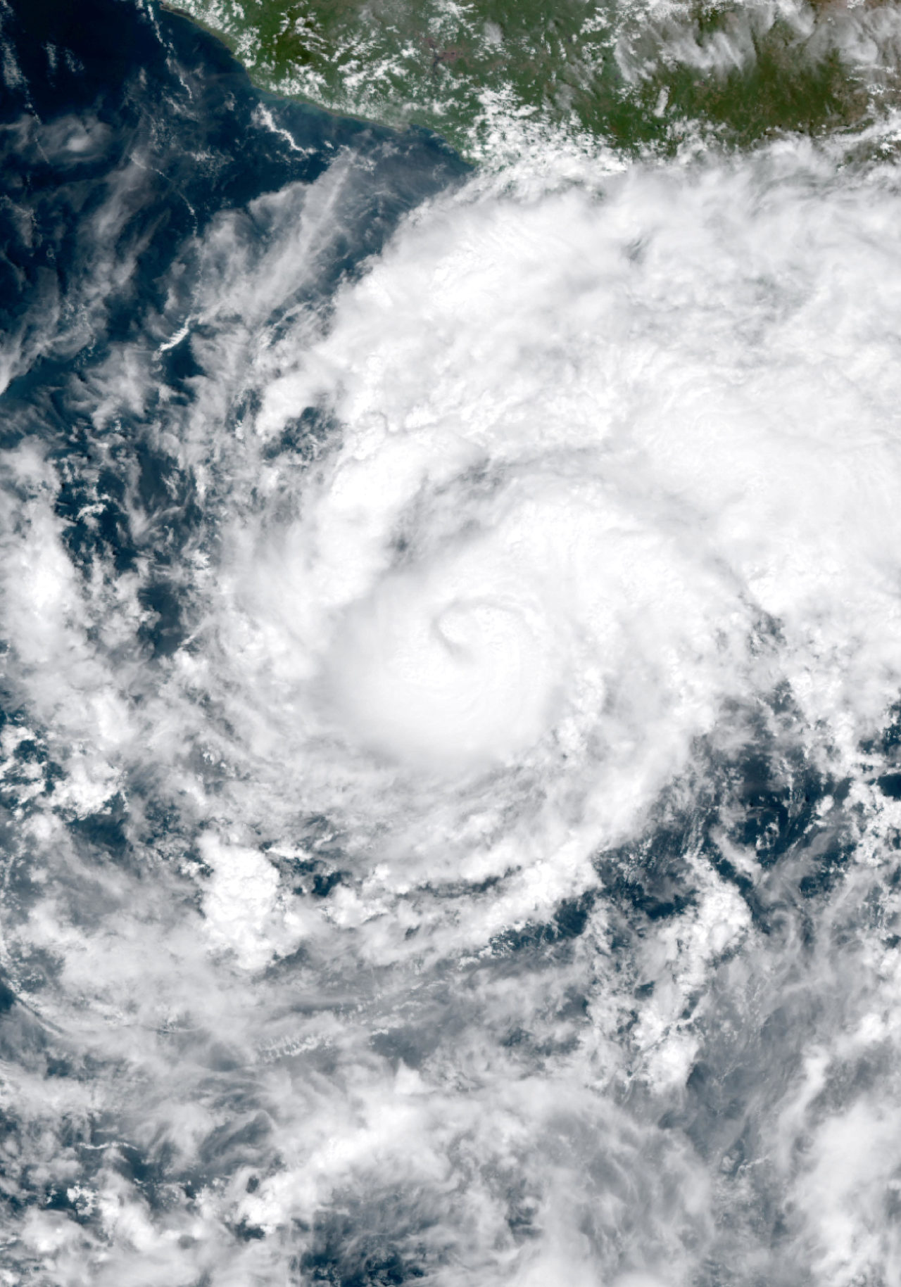
Global Weather Briefing for October 16, 2026
Major Hurricane Trudy was one of the day’s leading weather threats, with the National Hurricane Center continuing advisories Friday morning as the storm approached Mexico’s southwestern and west-central Pacific coast. Elsewhere, the past 24 hours also featured deadly flooding in Türkiye, active wildfire and smoke concerns in Southern California, and a severe-thunderstorm setup across parts of the U.S. Mid-Atlantic and southern New England. Nationally, the U.S. weather picture also included a typhoon approaching Guam, which appeared in the National Weather Service’s lead headline Friday.
Past 24 Hours
Outside the United States, the clearest confirmed high-impact event in the last day was flooding in Türkiye. Multiple credible reports indicated deadly flooding in and around Istanbul, and the event also appeared on GDACS’ active global flood list on Friday. Because casualty counts varied across secondary reports and no directly fetched primary civil-protection bulletin was available in this run, this summary avoids a specific number while noting that fatalities were reported and that urban flooding caused major disruption.
In the eastern Pacific, Hurricane Trudy remained a major hurricane Friday morning. The National Hurricane Center said at 6:00 a.m. CST that Trudy was centered near 14.5°N, 102.5°W, moving northwest at 6 mph with maximum sustained winds of 120 mph and minimum central pressure of 956 mb. NHC stated that the storm was forecast to approach the southwestern and west-central coast of Mexico this weekend. The NHC overview page also showed Tropical Storm Simon in the eastern Pacific, while the Atlantic remained free of active tropical cyclones Friday morning.
In Southern California, hot and windy conditions were helping sustain brush-fire concerns. Nationally, AirNow also displayed a system alert saying wildfire smoke was affecting air quality in multiple states, underscoring that smoke impacts extended beyond areas immediately adjacent to active fire lines.
What’s Happening Now
Trudy remained one of the most significant ongoing hazards in the Americas at the time of writing. NHC was issuing advisories for the eastern Pacific on Hurricane Trudy and Tropical Storm Simon, while also reporting no tropical cyclones in the Atlantic. For Mexico, the main near-term concerns were hurricane-force winds near the core, heavy rain, and coastal hazards as Trudy continued tracking toward land. As of the latest public NHC advisory, a Hurricane Watch was in effect for the coast of Mexico north of Punta San Telmo to Cabo Corrientes, and a Tropical Storm Warning was in effect for the coast from Manzanillo southward to Zihuatanejo. Simon had no coastal watches or warnings in effect.

Across the western United States, wildfire and smoke remained an important active hazard category. NIFC’s Friday morning national summary listed 12 large fires being suppressed and 690,806 acres burned in large fires, while AirNow’s national alert highlighted wildfire smoke impacts in multiple states. That combination points to continuing fire-weather and air-quality concerns even where flames are not immediately visible to the public.
Global monitoring pages also showed additional weather hazards in progress beyond North America. GDACS listed active flood events in countries including Colombia, Türkiye, the United States and Chile, alongside several active tropical cyclones worldwide. Those listings reinforced that Friday’s weather picture remained globally busy even where official local bulletins were not directly retrievable here. In the western Pacific, official U.S. weather pages indicated a typhoon approaching Guam, and the Guam forecast office map showed a Typhoon Warning, Tropical Storm Warning, High Surf Warning, Typhoon Watch, Flood Watch, and Coastal Flood Watch in effect for Guam and the Marianas.
Outlook Through Tonight

In the U.S., the Storm Prediction Center forecast a slight risk of severe thunderstorms from parts of the Mid-Atlantic into southern New England through tonight. SPC said thunderstorms capable of producing damaging winds, and perhaps a tornado or two, were expected mainly this afternoon and early evening, with the greatest coverage of damaging winds focused across parts of eastern Pennsylvania into New Jersey and southern New York.
The Weather Prediction Center’s Day 1 excessive-rainfall outlook showed a marginal flash-flood threat area on Friday. While that is a lower-end category, it supports the idea that locally heavy rain could still create problems where storms repeatedly track over the same areas. WPC’s Friday morning short-range discussion also highlighted a flash-flood risk across portions of Florida Friday into Saturday.
Along the U.S. West Coast and Southwest, smoke and fire-weather sensitivity remained part of the evening picture, especially where dry air and gusty winds overlap. In Mexico, Trudy’s approach was expected to keep coastal and marine conditions dangerous through tonight and into the weekend.

