
Global Weather Briefing for October 12, 2026

October 12, 2026 is being led by Hurricane Simon in the eastern Pacific, where the National Hurricane Center says dangerous winds and flooding rains are continuing along the coast of western Mexico. Elsewhere, Thailand remains in a significant flood emergency after weeks of high water, and U.S. weather agencies continue to flag heavy-rain concerns in parts of the Southwest and smoke-related air quality problems in multiple states.
Past 24 Hours
The most significant weather event in the past 24 hours has been Hurricane Simon near Mexico’s Pacific coast. As of the National Hurricane Center’s morning update, Simon was centered just offshore of Mexico with maximum sustained winds of 115 mph and was moving northwest very slowly. NHC said dangerous winds and flooding rains were continuing along the coast, making Simon the clearest high-impact land threat in today’s global weather picture.
Thailand also remained under major flood stress. GDACS continued listing an active flood event in Thailand, and multiple published reports citing Thailand’s Interior Ministry said the death toll from flooding since mid-September had risen to 71, with hundreds of thousands of households affected. Because those impact figures come from published reporting rather than directly from a primary agency page we could retrieve here, they should be read as externally reported totals rather than independently re-tabulated figures.

In the United States, the National Weather Service said remnant moisture from former Tropical Storm Rachel would keep a heavy-rain threat in place across parts of the Great Basin and Southwest on Monday. The Weather Prediction Center’s Day 1 Excessive Rainfall Outlook also showed both slight- and marginal-risk areas, underscoring that localized flash flooding remains a concern even though the Storm Prediction Center forecast no organized severe thunderstorm areas for today.
What’s Happening Now
Right now, Hurricane Simon is still the most urgent ongoing hazard among the verified events reviewed for this briefing. NHC continues to issue advisories for the eastern Pacific system and says dangerous coastal impacts are ongoing in western Mexico. The Atlantic basin, by contrast, has no tropical cyclones at this time, according to NHC.
Thailand’s flood emergency also remains active. GDACS continues to list Thailand among active flood events, keeping it high in today’s ranking because of its sustained human impact and broad exposure. Additional active global flood entries on the GDACS homepage included the United States, China, and Mexico, but the strongest directly sourced narrative signal available in this run remained Thailand.
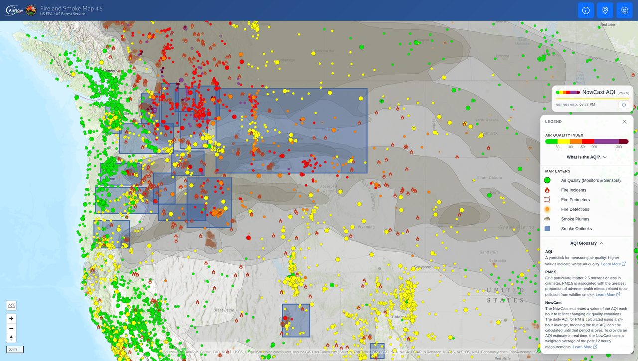
Air quality is another active U.S. concern. AirNow’s homepage carried a system alert for wildfire smoke impacting multiple states and directed users to the Fire and Smoke Map to check local conditions. That alert does not by itself quantify where the worst smoke is at this hour, but it is sufficient to confirm a multi-state smoke concern remains active.

Outlook Through Tonight
Through 11:59 PM ET tonight, the U.S. forecast emphasis remains on heavy rain in parts of the Southwest and on anomalous warmth spreading across the Plains and Midwest. The National Weather Service headline called for the heavy-rain threat to continue Monday, while also highlighting record warmth developing across the Plains and Midwest and expanding toward the Lower Mississippi Valley and Southeast later in the week.
For flash-flood potential, the Weather Prediction Center’s Day 1 Excessive Rainfall Outlook remains the most direct national baseline product. It shows a slight-risk area affecting nearly 3.9 million people and a broader marginal-risk area affecting more than 28 million people, according to the WPC page summary. Meanwhile, the Storm Prediction Center’s Day 1 Convective Outlook says no severe weather is forecast across the U.S. today and tonight, which lowers the nationwide tornado and organized severe-thunderstorm concern relative to the flooding risk.
In the eastern Pacific, Simon will remain a closely watched coastal hazard as long as NHC advisories continue to describe dangerous winds and flooding rains along western Mexico. Even without a U.S. land threat, Simon stays at the top of today’s briefing because of the direct and ongoing coastal impacts already verified in official NHC text.



,(_September_27,_2026).jpg)
