
Global Weather Update for October 10, 2026

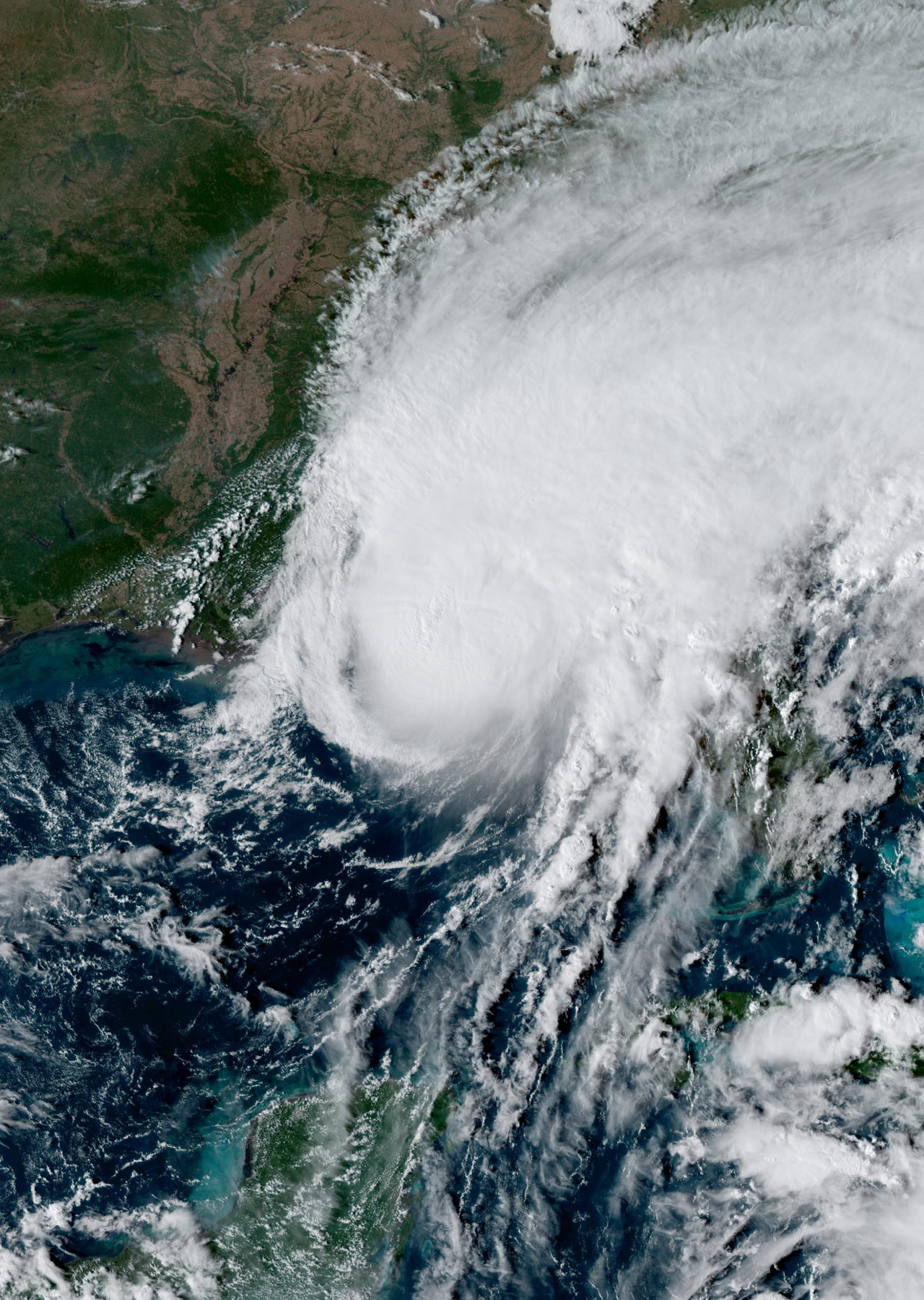
October 10, 2026 is being dominated by two tropical systems with very different footprints. In the southeastern United States, Post-Tropical Cyclone Isaias is still producing a serious flood threat after coming ashore, with the National Hurricane Center warning that considerable flash flooding remains possible from southern Alabama and the Florida Panhandle into southwestern Georgia, and that heavier rain may also affect parts of the southern Appalachians and coastal Carolinas. Farther west, Tropical Storm Rachel is moving toward Baja California and the U.S.-Mexico border, where official forecasts call for heavy rain, coastal flooding, dangerous surf, and strong winds extending into Southern California and the Southwest.
Past 24 Hours
The most significant observed weather event of the past day was Isaias, which made landfall Friday evening on the Florida Panhandle before transitioning to a post-tropical cyclone. As of the National Hurricane Center’s last advisory early Saturday, the center was over Alabama and the flooding risk remained the leading concern. NHC said 4 to 8 inches of rain were expected across southern Alabama, the Florida Panhandle and Big Bend, and southwest Georgia, with localized totals up to 15 inches possible in the banding. The Weather Prediction Center said hurricane-force winds and life-threatening storm surge had affected portions of coastal Alabama and the Florida Panhandle, even as the storm lost tropical characteristics inland.

Elsewhere, global monitoring sources highlighted several ongoing international weather hazards, but the best-verified major event outside the United States was Rachel in the eastern Pacific. GDACS listed both Rachel and Hurricane Simon among active tropical cyclones on Saturday, but Rachel stands out for its direct land threat to northern Baja California and the far southwestern United States during the covered period.
What’s Happening Now
Flooding remains the main active hazard from Isaias this morning and into the day. The National Weather Service says tropical moisture tied to Isaias is spreading flash-flood, strong-wind, and tornado concerns farther into the Southeast. SPC’s latest Day 1 outlook places eastern Georgia into western and southern South Carolina in a slight risk area for severe thunderstorms, with several brief tornadoes possible as the former tropical cyclone interacts with a warm, unstable air mass. The Tallahassee forecast office also warns that a band of heavier rain could redevelop over the Florida Big Bend and south-central Georgia, bringing pockets of 3 to 5 inches of rain.
Rachel is the other major active concern. The National Hurricane Center says the storm is moving east-northeast toward Baja California Mexico, with a tropical storm warning posted for part of the Baja coast and a tropical storm watch extending north to the Southern California coast from the U.S.-Mexico border to the San Diego/Orange County line. NHC says Rachel could bring 1 to 3 inches of rain, with local totals up to 5 inches, to parts of the Southwest this weekend, along with the potential for significant flash and urban flooding. It also warns that moderate to major coastal flooding is expected as high waves combine with elevated water levels along parts of the Southern California and northern Baja coast.

A third active weather story is unfolding across the northern Rockies, where the first notable mountain snow of the season is arriving. The Missoula forecast office warns that snow from late Saturday through Monday morning will mainly affect elevations above 4,000 feet, with the heaviest accumulations near the Continental Divide in southwest Montana. Freeze warnings are also posted in parts of the region as much colder air pushes southward behind a strong cold front.
Outlook Through Tonight
Through 11:59 PM Eastern, the main life-safety concerns remain flash flooding in the Southeast from Isaias and the expanding wind, surf, and flood threat near the U.S.-Mexico border from Rachel. In the Southeast, the storm center is expected to keep tracking northward while heavy rain shifts inland toward the Tennessee Valley and Appalachians. In the Southwest, Rachel is forecast to approach and move ashore near the border tonight, with deteriorating coastal and inland conditions likely late in the day and overnight.
Additional forecast hazards include elevated fire weather conditions across parts of Nevada, eastern Wyoming, southwestern South Dakota, and the Nebraska Panhandle, where dry air and gusty winds are expected to overlap. The broader western temperature pattern is also changing quickly, with much cooler air spilling into the Great Basin and northern Rockies behind the incoming trough.
Overall, the global weather picture today is being defined by compound hazards: inland flooding after tropical landfall in the Southeast, a new tropical threat bearing down on Baja California and Southern California, and early-season snow and freeze impacts spreading across the northern Rockies.




