Southwest severe storm threat and Mid-Atlantic coastal flooding: Weather briefing for October 21, 2026
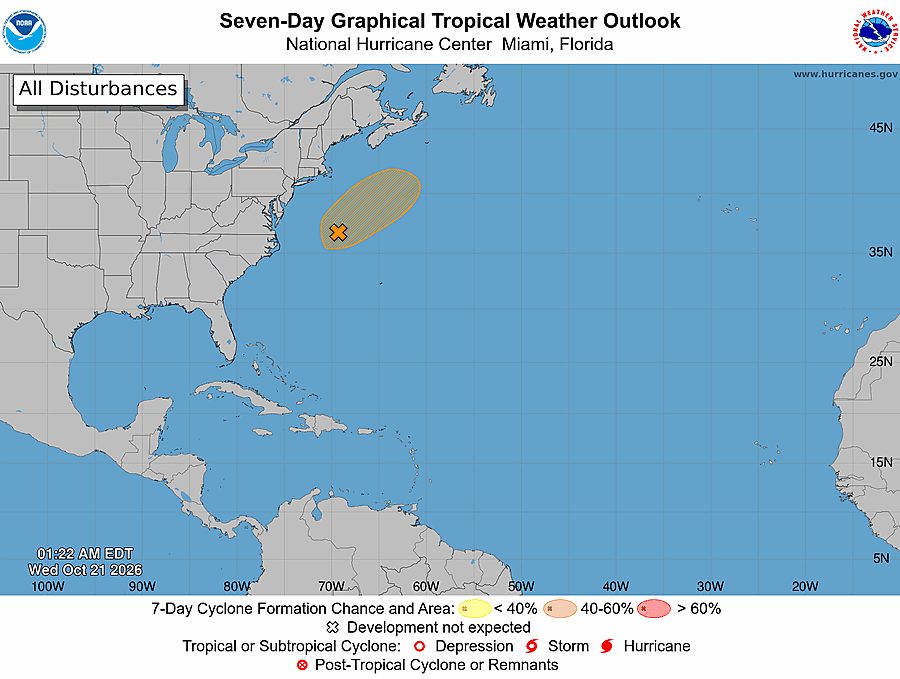
Strong storms in Arizona and coastal flooding along the Mid-Atlantic were the main U.S. hazards on Wednesday. No tropical cyclones were active in the Atlantic, eastern Pacific or central Pacific, the National Hurricane Center said, and the National Weather Service said Guam and the Northern Mariana Islands had no active tropical cyclones or local watches and warnings in effect.
Past 24 Hours
Recovery work continued in Guam and the Northern Mariana Islands after Super Typhoon Champi, with local reporting through Wednesday describing homes and roads still affected after the storm passed the region. Guam remained out of immediate tropical danger Wednesday, and the National Weather Service office in Tiyan said there were no active tropical cyclones or local watches and warnings in effect.
What's Happening Now
An enhanced risk of severe thunderstorms was posted for parts of central and northwestern Arizona on Wednesday, where the Storm Prediction Center said storms along the Mogollon Rim could produce hail larger than 2 inches, severe wind gusts and a couple of tornadoes from afternoon into evening. The same system also brought an isolated tornado threat to parts of the southern and central California coast as showers and low topped thunderstorms moved onshore.
Along the Mid-Atlantic coast, the National Weather Service warned that a nor'easter well offshore was still driving strong onshore winds, coastal flooding, beach erosion and dangerous marine conditions. The storm was expected to drift north this week and could take on some subtropical characteristics, but its immediate impact Wednesday was coastal water and surf, not tropical development.
The Weather Prediction Center said a slight risk of excessive rainfall was in effect Wednesday for portions of central and southern California and the Four Corners, where flash flooding was possible. The same Pacific moisture also helped limit fire weather concerns, and the Storm Prediction Center said no critical fire weather areas were forecast for Wednesday.
Outlook Through Tonight
Arizona stays the most focused severe weather area through tonight. The Storm Prediction Center said the strongest supercells near the Mogollon Rim could persist into the evening, with the risk of very large hail, damaging winds and a few tornadoes before activity weakens overnight.
Southern and central California will also keep a lower end severe risk into tonight as rotating coastal storms move inland. Any stronger cell could still bring an isolated tornado or a severe wind gust where it reaches the coast.
Flooding and beach erosion concerns will continue along parts of the Mid-Atlantic coast tonight as persistent onshore flow holds water levels up. Elsewhere across the U.S., the fire weather picture is quieter than it has been at times this month, with broader Pacific moisture suppressing more critical conditions in the West.

