
Daily Weather Briefing for October 19, 2026
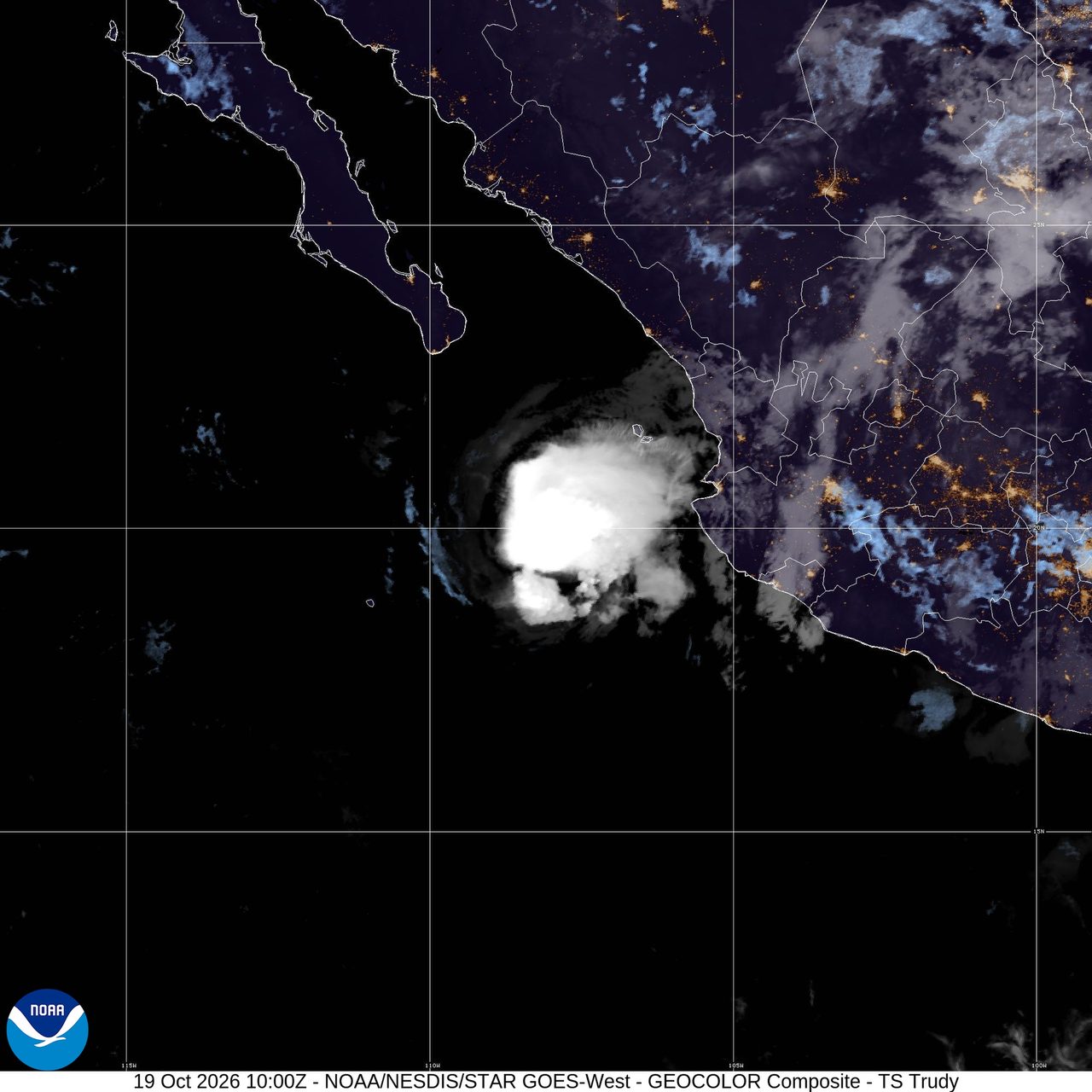
A quieter convective pattern across the lower 48 is keeping widespread U.S. severe thunderstorms off the board today, but several meaningful weather hazards remain in focus worldwide. Along the U.S. East Coast, a nor’easter is driving hazardous coastal conditions in the Mid-Atlantic, with the National Weather Service warning of significant coastal flooding and beach erosion potential through midweek. In the eastern Pacific, Tropical Storm Trudy continues to weaken west of Mexico, though dangerous surf and rip currents are still affecting parts of the southwest and west-central Mexican coast. Elsewhere in the U.S., fire-weather concerns remain elevated in parts of northeastern California, southern and southeastern Oregon, and northwestern Nevada, while a separate strong storm is approaching southern Alaska with high winds and heavy precipitation.
Past 24 Hours
The most notable observed global weather impact in the period was the continued coastal hazard setup along the Mid-Atlantic. The National Weather Service highlighted a nor’easter creating hazardous marine and coastal conditions, with significant coastal flooding and beach erosion possible. It is an active hazard affecting a densely populated coastline.
In the eastern Pacific, Tropical Storm Trudy remained an active system early today. The National Hurricane Center said at 2:00 a.m. MST that Trudy was centered near 19.7°N, 108.0°W with maximum sustained winds of 60 mph and minimum central pressure of 999 mb. NHC said Trudy is rapidly weakening and that swells generated by the storm will continue affecting portions of the coast of southwestern and west-central Mexico through today, with life-threatening surf and rip current conditions possible. No coastal watches or warnings were in effect with the latest advisory.

Wildfire conditions were also part of the U.S. weather picture, though not at peak national levels. The National Interagency Fire Center listed 13 large fires being suppressed nationwide in its latest summary, with 691,662 acres burned in large fires as of Sunday. AirNow also carried a system alert noting wildfire smoke is affecting air quality in multiple states, underscoring that smoke remains a continuing health concern even where flames are not the lead national weather story. In the western Pacific, NWS Guam showed no active tropical cyclones for Guam and the Marianas, though High Surf Advisory and Rip Current Statement products were posted there.
What’s Happening Now
The leading active U.S. hazard is coastal along the Mid-Atlantic, not convective. The Storm Prediction Center’s Day 1 Convective Outlook said severe thunderstorms are not forecast across the U.S. today or tonight. Instead, the broader national focus has shifted to coastal flooding, surf, and erosion risk in the Mid-Atlantic, where the National Weather Service says the nor’easter will continue to create dangerous marine and shoreline conditions through midweek.
Farther north, southern Alaska is bracing for a strong storm system. The National Weather Service homepage highlighted high winds and heavy precipitation for portions of southern Alaska, making it one of the more consequential U.S. active hazards outside the Mid-Atlantic coastal zone.

In the Southwest and Great Basin, fire-weather conditions are elevated rather than extreme, but still notable. The SPC Day 1 Fire Weather Outlook placed northeastern California, southern and southeastern Oregon, and northwestern Nevada under elevated fire-weather conditions, citing sustained winds of 15 to 20 mph with localized gusts of 25 to 30 mph and humidity falling into the upper teens and low 20s.

Over the eastern Pacific, Trudy remains a named tropical cyclone, but the immediate land threat is limited mainly to hazardous surf and marine conditions as the storm weakens offshore. NHC said the storm is expected to continue weakening and become post-tropical by tonight. No watches or warnings were in effect with the latest advisory.
Outlook Through Tonight
Through 11:59 p.m. ET, the U.S. severe thunderstorm outlook remains muted. SPC says no severe thunderstorms are forecast across the country today or tonight, a notable contrast with more active autumn patterns. South Florida and parts of the Desert Southwest may still see thunderstorms, but not with an organized severe threat in the national outlook.
The Mid-Atlantic coastal hazard will continue to be the most immediate U.S. concern into tonight as the nor’easter maintains rough marine conditions and the potential for coastal flooding and beach erosion. In southern Alaska, the incoming storm is expected to keep high winds and heavy precipitation in play. In the western U.S., elevated fire-weather conditions are expected to persist through the day in parts of California, Oregon, and Nevada.
In the eastern Pacific, NHC expects Trudy to weaken further and become post-tropical by tonight, while also monitoring an area of disturbed weather several hundred miles south of Guatemala with a medium chance of development in 48 hours and a high chance over seven days. That disturbance is a forecast concern only for now and is not yet a named system.


