
Global Weather Briefing for September 30, 2026

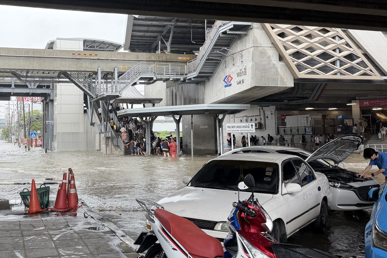
September 30, 2026 brought a broad mix of weather hazards across the globe, led by major flooding in Thailand that continued to disrupt transportation, industry and daily life in and around Bangkok. In the United States, the near-term focus was on heavy rain from the Southwest into the Plains and a severe-thunderstorm threat centered on parts of Kansas, Oklahoma and Texas. In the central Pacific, Tropical Storm Nolo remained an active concern for Hawaii waters, with the National Hurricane Center warning of flooding rain, high surf and tropical-storm conditions in parts of the Papahanaumokuakea Marine National Monument.
Past 24 Hours
Thailand remained the clearest high-impact weather disaster in the past day. Reporting from The Star and the Bangkok Post said flooding had forced temporary shutdowns at four Toyota plants, disrupted Thai Airways cargo operations, affected Bangkok’s main airport operations, and pushed evacuations in some communities west of the capital. The Bangkok Post also reported that authorities listed 40 fatalities across four regions, while officials continued pumping water from flooded areas and warned that more runoff from the north could keep Bangkok and surrounding areas at risk.
In the western United States, wildfire season remained active even where fire behavior was generally described as minimal to moderate. The National Interagency Fire Center said firefighters were working on 26 large fires nationwide in its latest Friday-updated report, with especially large acreage still burning in Washington and Oregon. AirNow also continued to carry a national alert for wildfire smoke affecting multiple states, underscoring that smoke exposure remained part of the broader weather-health picture even outside the most active fire zones.

What’s Happening Now
Tropical Storm Nolo was moving west across the central Pacific early Wednesday, and the Central Pacific Hurricane Center said it was still bringing dangerous conditions to portions of the Papahanaumokuakea Marine National Monument. A tropical storm warning remained in effect from Nihoa to French Frigate Shoals, with a tropical storm watch farther west toward Maro Reef. Nolo’s outer rain bands were forecast to bring 3 to 6 inches of rain to Kauai and Niihau through Thursday, along with possible flooding and mudslides in steep terrain, while large surf and rip-current hazards continued along exposed shores.

Across the continental United States, the National Weather Service said heavy rainfall was continuing from the Southwest into the Plains, with severe thunderstorms expected in parts of the southern Plains. The Storm Prediction Center’s Day 1 outlook highlighted a slight risk of severe thunderstorms from parts of west Texas into southwest Oklahoma, along with a tornado risk in Kansas and possibly far southeast Nebraska. The Weather Prediction Center’s Day 1 excessive-rainfall outlook showed millions of people inside slight and moderate flash-flood risk areas, adding to concern where repeated rounds of rain have already saturated the ground.
Outlook Through Tonight
Through 11:59 p.m. ET tonight, the main U.S. forecast hazards remain severe thunderstorms and flooding rain in the Plains and adjacent Southwest. The Storm Prediction Center said thunderstorms capable of severe wind gusts, some hail and a brief tornado were expected this afternoon and tonight, especially across the southern Plains. Farther north, Kansas and nearby parts of Nebraska could see a few tornadoes if storms strengthen near the effective warm front.
Flooding risk will also remain elevated where the Weather Prediction Center has posted excessive-rainfall threat areas. The Weather Prediction Center’s Day 1 outlook showed more than 12 million people inside a moderate flash-flood risk area and more than 26 million inside a slight risk area. In Hawaii, Nolo’s rain and surf impacts are expected to continue through tonight and into Thursday, while in Thailand officials are already bracing for additional heavy rain early next week even as current floodwaters continue to strain transport and recovery efforts.


