
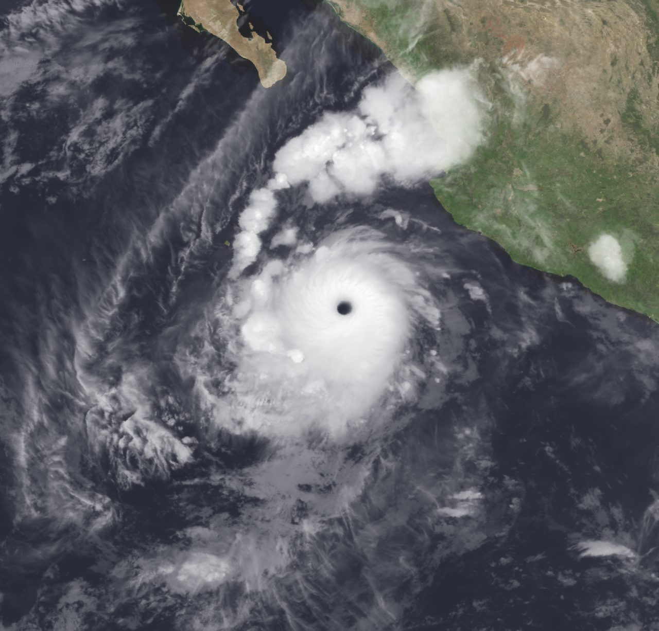
Global Weather Briefing for September 29, 2026
Heavy rain from the Southwest into the southern Plains remains the leading weather concern through tonight, with NOAA highlighting considerable flash-flood potential across parts of New Mexico and west Texas as tropical moisture feeds into a broader storm system.
Past 24 Hours
The most consequential weather story over the past day has been the expansion of a heavy-rain event from the U.S. Southwest toward the southern Plains. NOAA’s National Weather Service said tropical Pacific moisture wrapping into a storm over the Southwest would sustain a multi-day event, while the Weather Prediction Center’s Day 1 Excessive Rainfall Outlook showed millions of people inside slight to moderate flash-flood risk areas. The Storm Prediction Center also placed parts of southern and eastern New Mexico into west Texas under a marginal severe-thunderstorm risk, with isolated damaging gusts and a tornado or two possible as the moisture plume interacts with stronger winds aloft.

Farther south, Hurricane Polo remained a major regional weather system early Tuesday as it crossed the Gulf of California and moved into Sonora. The National Hurricane Center said at 5:00 AM MST that Polo was near 26.9N, 111.7W with maximum sustained winds of 75 mph. While the center was expected to weaken over the mountainous terrain of northern Mexico, its moisture was forecast to continue feeding the rain and thunderstorm threat into the Southwest and southern Plains.

Globally, the tropical basins remained active, but most other named systems cited by the National Hurricane Center were away from major land areas. Tropical Storm Rachel was better organized offshore of southwestern Mexico on Tuesday morning, while Atlantic storms Fay and Hanna stayed over the open ocean. In the central Pacific, Hurricane Nolo was spreading dangerous marine conditions across the southeastern waters of Papahanaumokuakea Marine National Monument rather than producing a major land threat.
What’s Happening Now
As of Tuesday morning in the eastern U.S., the immediate active hazard is the corridor of heavy rain and flash-flood risk stretching from the Southwest into parts of the south-central United States. The Weather Prediction Center’s Day 1 outlook showed a moderate excessive-rainfall area affecting nearly 5 million people, with a broader slight-risk area covering more than 11 million. Weather.gov’s national headline likewise emphasized heavy to excessive rainfall this week, specifically warning of considerable flash flooding across portions of New Mexico and west Texas today through Wednesday.
Air quality is also an active concern in parts of the United States. AirNow’s national alert page said wildfire smoke is affecting air quality in multiple states, and advised the public to use the Fire and Smoke Map to check local impacts. NIFC reported 17 large fires being suppressed nationwide as of Tuesday morning, with 1,681,161 acres burned in large fires and the national preparedness level at PL 2.
In northwestern Mexico, Polo remains the key tropical weather system with land relevance today. Although weakening is expected after its move inland, the storm still matters because of the rain and moisture transport associated with it, especially for Sonora and downstream areas farther north and northeast.
Outlook Through Tonight
Through 11:59 PM ET, the main forecast concern remains flooding rain from southern and eastern New Mexico into west Texas, with thunderstorms continuing in a very moist environment. The Storm Prediction Center said isolated severe wind gusts and a localized tornado threat could continue this afternoon and evening as storms become better organized.
Additional thunderstorm activity is also possible across southeast Arizona, where SPC said strong wind profiles could support locally strong storms and pockets of damaging wind. Along the coasts, the National Weather Service continued to carry more localized hazards such as minor coastal flooding around parts of the New York City metropolitan shoreline and patchy dense fog advisories in a number of states, but those threats are secondary compared with the broader Southwest rain event.
Outside the United States, tropical monitoring continues across the Atlantic, eastern Pacific and central Pacific basins tonight. The storms with the clearest land impacts tonight are Polo in northwestern Mexico and its rain shield extending into the U.S. Southwest.


