
Global Weather Briefing for October 17, 2026
Below is the saved daily weather blog draft for October 17, 2026, based on available official and baseline sources.
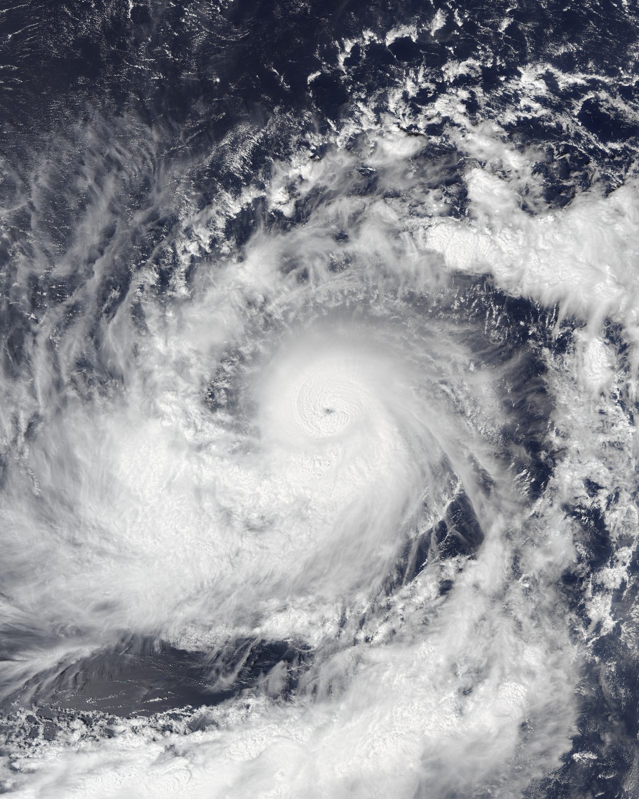
Typhoon Champi near Guam and Hurricane Trudy off Mexico are among the most prominent active weather hazards today, with the U.S. National Weather Service also highlighting severe thunderstorms in the Mid-Atlantic and Northeast and wildfire smoke affecting air quality in multiple states.
Past 24 Hours
Over the past day, the most consequential observed weather story has been Typhoon Champi in the western Pacific. The National Weather Service home page highlighted a typhoon approaching Guam, underscoring a direct life-safety concern for the island and surrounding waters. Available baseline material confirms the hazard is active and significant, though detailed local impact reports were not available in the retrieved source set.

Farther east, Hurricane Trudy remained a major weather concern in the eastern Pacific. The National Hurricane Center said early Saturday that Trudy was holding steady while moving northwestward and was expected to pass near the coast of west-central Mexico later today into Sunday. As of the latest advisory visible on the NHC homepage, Trudy was located near 16.0°N, 103.4°W with maximum sustained winds of 90 mph and a minimum central pressure of 979 mb.
In the United States, strong thunderstorms were part of the weather picture late Friday into Saturday. The National Weather Service said severe thunderstorms were a concern for the Mid-Atlantic and Northeast as a cold front swept eastward. Those storms were part of a broader active pattern, but the Storm Prediction Center’s latest Day 1 outlook for Saturday indicates organized severe thunderstorms are not expected today, suggesting the more robust severe threat was tied to the preceding period.
What’s Happening Now
Typhoon Champi remains one of the most urgent active hazards in the roundup because it is nearing Guam, where high winds, heavy rain and hazardous marine conditions can create immediate risk. NWS Guam shows a Typhoon Warning, Tropical Storm Warning, Flash Flood Warning, Coastal Flood Warning, High Surf Warning and Typhoon Watch in effect for Guam and the Marianas.
Hurricane Trudy is also active in the eastern Pacific. As of the National Hurricane Center advisory issued at 3:00 a.m. CST Saturday, Trudy remained a hurricane with maximum sustained winds of 90 mph and a minimum central pressure of 979 mb. Warnings in effect include a Hurricane Warning from Manzanillo northward to Cabo Corrientes, a Hurricane Watch from south of Manzanillo to Punta San Telmo, a Tropical Storm Warning from south of Manzanillo to Zihuatanejo and from north of Cabo Corrientes to Punta Mita, and a Tropical Storm Watch from north of Punta Mita to San Blas and for Las Islas Marias.

Elsewhere across the tropics, GDACS lists Cyclone Wati and Typhoon Champi among active global tropical cyclones. Wati appears in the South Pacific system list, while GDACS also shows Champi as an intense western Pacific cyclone. These listings support a broader pattern of active tropical weather outside the Atlantic, where NHC says there are no tropical cyclones at this time.
In the U.S., smoke remains a secondary but meaningful hazard. AirNow is carrying a system alert that wildfire smoke is affecting air quality in multiple states, and advises users to consult the Fire and Smoke Map for local conditions. NIFC, meanwhile, reports the national wildfire preparedness level is at PL 1, indicating that while smoke impacts are notable in some areas, nationwide fire-resource strain remains comparatively low.
Outlook Through Tonight
Through 11:59 p.m. ET, one of the most important forecasts remains the continued approach of Typhoon Champi toward Guam. Residents and mariners in the region should monitor official warnings closely as conditions can deteriorate quickly around tropical cyclones even before the center arrives.
Along Mexico’s west-central coast, Hurricane Trudy is expected to pass near the shoreline later today into Sunday, keeping surf, rain and wind hazards elevated. Forecast confidence is high that Trudy remains a significant eastern Pacific hurricane tonight, based on NHC’s ongoing advisory package.
Across the continental United States, the severe-weather outlook is comparatively lower today. The latest SPC Day 1 Convective Outlook says no severe thunderstorm areas are forecast, though localized strong gusts may still occur in Florida. The Weather Prediction Center also highlights a developing coastal low expected to bring heavy rain, gusty winds, hazardous marine conditions, coastal flooding and beach erosion along portions of the Mid-Atlantic coast into early next week, while elevated to critical fire-weather conditions persist across portions of California into Sunday.


.png)
