District of Columbia Weather Radar
As of 10:30 PMLive radar
Open full mapRight now across District of Columbia
 66°
66°
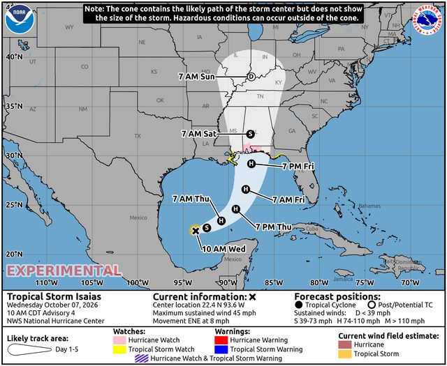
Hurricane Isaias
1186 mi SW of Washington · moving NE at 13 mph
- Max wind
- 100 mph
- Pressure
- 974 mb
- Updated
- 7:00 PM CDT Thu Oct 8
District of Columbia climate
Washington, DC has a humid subtropical climate shaped by its position between the Atlantic coast and the Appalachian foothills, where the Potomac and Anacostia rivers meet. The city sees four distinct seasons, with roughly 40 inches of precipitation spread fairly evenly through the year and an urban heat island that keeps the downtown core noticeably warmer than the surrounding suburbs on calm nights.
Summers are hot and humid, with July highs near 90 degrees Fahrenheit and frequent afternoon thunderstorms; the June 2012 derecho knocked out power across the region in the middle of a heat wave. Winters are variable: many seasons bring only a few inches of snow, but coastal storms can bury the city, as in the Knickerbocker storm of 1922 and the back-to-back blizzards of February 2010.
Spring and autumn are the mildest seasons, with spring famous for the cherry blossoms around the Tidal Basin and autumn bringing dry, comfortable days. The remnants of tropical systems occasionally bring heavy rain and flooding along the Potomac, and low-lying neighborhoods near the rivers and Rock Creek are prone to flash flooding during intense downpours.
Nearby states
Weather briefing
All posts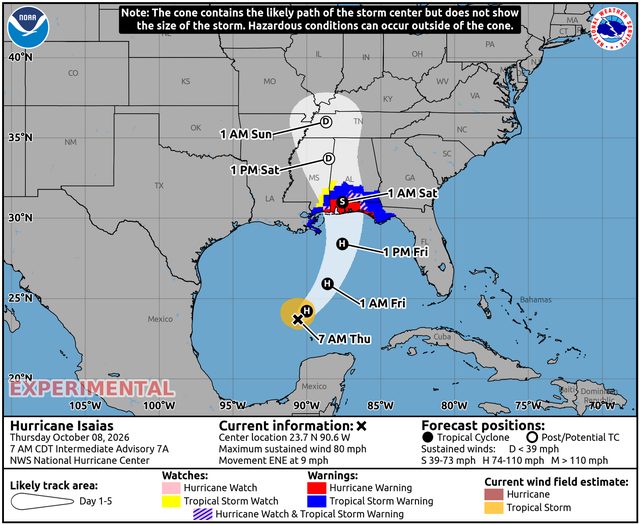
Explore the live map
Open mapPopular cities


