Cameroon Weather Radar
As of 12:27 AMLive radar
Open full mapRight now across Cameroon
17° to 28° 22°
22°
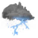 25°
25°
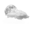 17°
17°
 28°
28°
Cameroon climate
Cameroon is often called "Africa in miniature" due to its extraordinary climatic and geographic diversity within a single country. The southern rainforest zone receives over 2,000mm of annual rainfall, while the semi-arid Sahel region in the far north receives less than 600mm. Mount Cameroon, at 4,095 meters, is the highest peak in West Africa and one of the wettest places on the continent, with its southwestern slopes receiving up to 10,000mm of rain annually at Debundscha.
The coastal city of Douala is one of the wettest major cities in Africa, averaging nearly 4,000mm of rainfall per year with the heaviest rains from June to October during the monsoon season. The central plateau around Yaound\u00e9 enjoys a more moderate climate with two distinct rainy seasons and temperatures averaging 24°C. The Adamawa Plateau in the center provides a transitional zone between the humid south and the dry north.
Northern Cameroon experiences a harsh Sahelian climate with a single short rainy season from June to September and searing dry-season temperatures that can exceed 40°C. Lake Chad, which borders the far north, has shrunk dramatically over recent decades due to changing rainfall patterns and increased water demand. Weather Scope helps users monitor Cameroon's remarkably varied weather, from coastal monsoons and highland mists to Sahelian heat waves and dust storms.
Nearby countries
Weather briefing
All posts


Explore the live map
Open map

